People seem to love our lil directions map on the ‘Get in Touch’ page of the website. We can be tricky to find even with a sat nav so the map is really helpful for finding us. Our couples are welcome to use the map in their wedding invitations or on their wedding websites for their guests. If you want to download the directions map, click here.
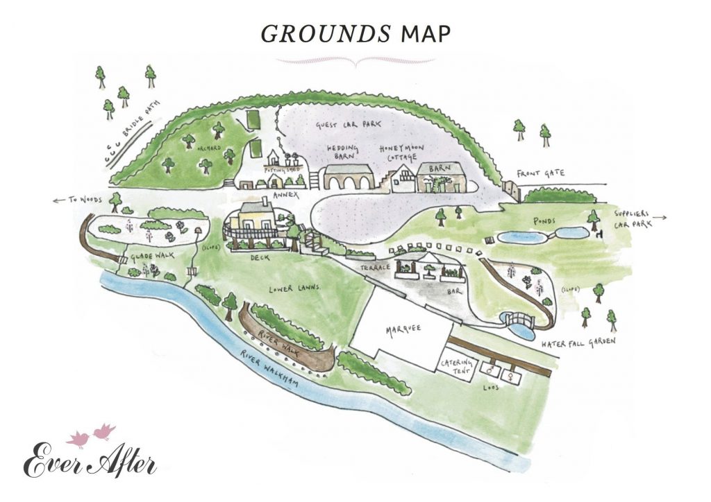
I’ve had a few requests for a map of the whole venue so I’ve now had a map of Ever After grounds drawn for us by the same person who drew the directions map.
So here it is!
 Our couples are welcome to use this map for their guests, we can email the file to any printers or web managers.
From entering the venue at the oak gates, visitors can turn right straight into the guest car park at the back of the venue. There’s a supplier’s car park just as you turn into the drive to the venue, you can see it marked on the right as you look at the map.
From the guest car park visitors walk past my potting shed and down the steps between the wedding barn and the annexe. The wedding barn is on one side of what is known as the horseshoe, with the steps to the decks and the lawn on the opposite side.
The wedding barn is located right next to the honeymoon cottage (no excuse for being late!) which is next to the old barn.
You can see the top ponds which lead down to the waterfall garden, the marquee on the lower lawns with the entrance to the riverwalk. The end of the riverwalk leads out at the other end of lower lawns to a glade walk by the river and then up some steps to the grass path to the woods. Visitors can either go through the gate into the woods (a Site of Special Scientific Interest) or turn right and walk along the grass path to the steps to the orchard with its wild meadow flowers and mown paths. The end of the garden is marked by a white rose hedge and a rose arbour newly planted in 2017.
So there it is, a whistle stop tour of the grounds so you can see how one part of the venue flows into the next.
If you’d like to download a copy of our digital summer brochure, click here.